Subsurface Technology & Utility Locators
Specialized tools for visualizing subsurface assets.
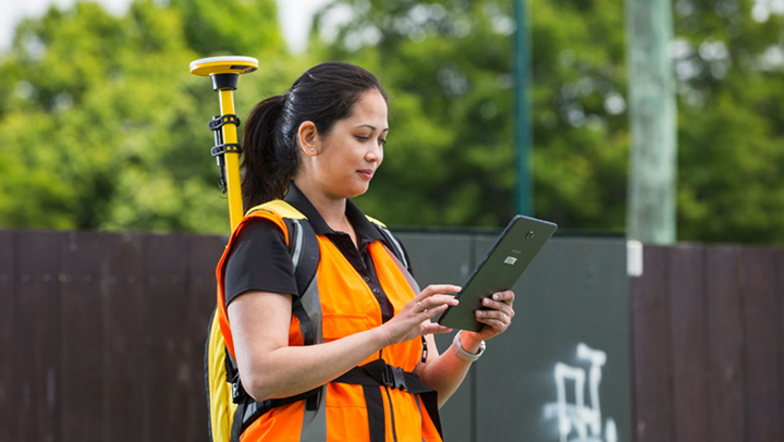
Utility locators and subsurface technology provide safe and accurate detection, mapping, and management of underground utilities and assets—eliminating the need for invasive digging.

Underground Insights. Above Ground Confidence
CSDS offers an extensive portfolio of field-to-finish subsurface technologies and utility locators that empower utility, construction, surveying, and engineering professionals to accurately detect, map, and manage underground utilities and structures for enhanced safety, efficiency, and decision-making.
Key Features:
- High-Precision Detection: Uses electromagnetic, HeliFlux®, and GPR sensors for accurate underground utility locating.
- Project Planning & Execution: Identifies hazards and risks for safe and cost-effective excavation.
- Seamless Integration: Supports GPS, GNSS, GIS, CAD, and asset management systems for seamless mapping.
- Real-Time Visualization: Displays subsurface data on high-resolution screens for better decision-making.
- Accurate Detection: Improves visibility of underground objects in complex environments.
- Depth Estimation & Signal Strength Indicators: Provides precise depth measurements and signal clarity.
- Wireless Data Sharing & Reporting: Enables field-to-office communication via Wi-Fi, Bluetooth, or cloud storage.
- Customizable Workflows: Adapts to industry-specific needs with API integrations and field applications.
- Durable Designs: Built to withstand harsh environments and rugged field conditions.
Applications:
Utility Mapping & Damage Prevention
Construction & Excavation
Infrastructure Development
Mining and Quarrying
Forensics and Accident Reconstruction
Asset Management
Military & Defense
Environmental & Archaeology
Forensics & Law Enforcement
A Collection of Trusted Brands
CSDS partners with the most trusted brands in the industry to provide reliable and innovative solutions.

Precision Locator Range from Radiodetection

RD8200SG Survey Grade Locator
Locate and map buried utilities in one seamless operation. Combine advanced utility locating with survey-grade mapping for unmatched precision, accuracy, and adaptability in any work environment.
Featured Precision Locator Ranges
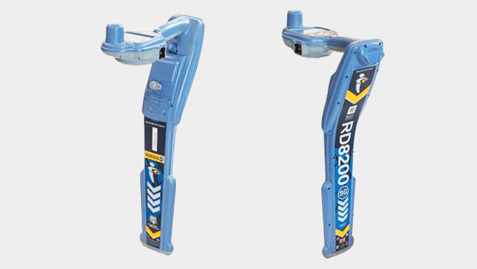
Radiodetection RD8200SG Survey Grade Locator
Locate and map buried utilities in a single operation.
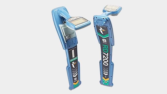
Radiodetection RD7200 Cable and Pipe Locator
Quickly detect underground utilities, reduce damage risks, and ensure reliable mapping.
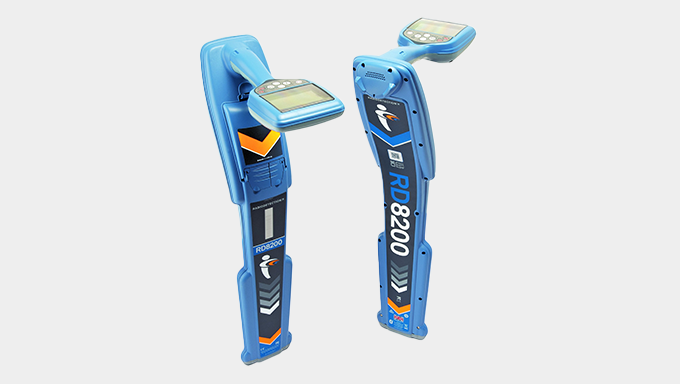
Radiodetection RD8200 Cable and Pipe Locator
Advanced underground locator for precise, survey-grade mapping and detection of subsurface assets.
LMX® Ground Penetrating Radar (GPR) Systems | Sensors & Software from Radiodetection
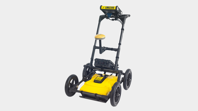
LMX200™ GPR System
The Radiodetection LMX200™ GPR System delivers real-time detection and mapping of buried utilities and structures, featuring in-field capabilities like Grid Scan data collection, SplitView, and MapView, along with GPS integration and seamless data export for improved accuracy and efficiency.
Featured LMX Ground Penetrating Radar (GPR) Systems
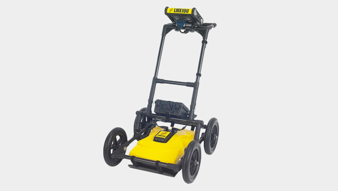
Sensors and Software LMX100 Ground Penetrating Radar (GPR) System
User-friendly, entry-level GPR utility detector solution for comprehensive underground infrastructure visualization.
Sensors and Software LMX200 Ground Penetrating Radar (GPR) System
A cutting-edge GPR solution that delivers enhanced insights and confidence in detecting subsurface features with precision and reliability.
Schonstedt Magnetic Locators from Radiodetection
Featured Schonstedt Magnetic Locators
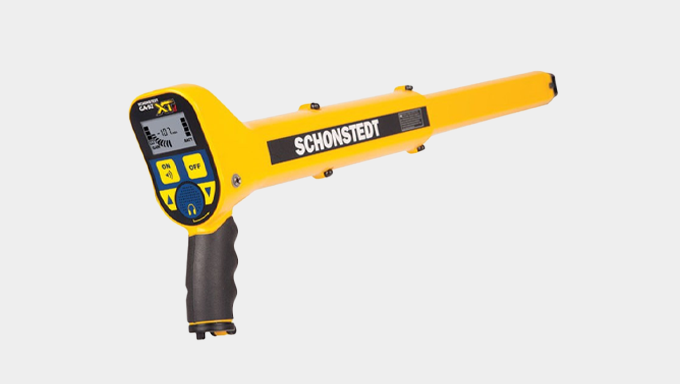
Schonstedt GA-92XTd Magnetic Locator
Confidently detect and ferrous objects with dependable precision.
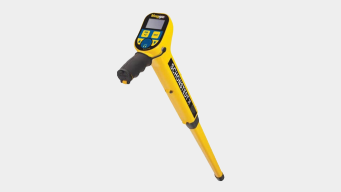
Schonstedt MAGGIE Magnetic Locator
High-sensitivity detection combined with rugged durability for reliable identification of underground assets.
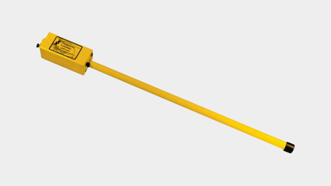
Schonstedt GA-52Cx Magnetic Locator
Reliable, user-friendly handheld magnetic locator built for utility, construction, and surveying professionals.

TerraFlow Utility Mapper
The TerraFlow Utility Mapper is the industry’s most advanced and configurable mapping software for locating, managing, and integrating subsurface asset data with GIS, enterprise asset management, CAD, and other business systems.

Additional Tools for Subsurface Detection & Management
Cansel offers a comprehensive selection of other subsurface solutions and accessories that further enhance the identification, mapping, inspection, and management of underground infrastructure.
Featured Expanded Solutions
Pipeline Integrity & Corrosion Control
Detect and prevent pipeline corrosion, leaks, and structural weaknesses with advanced locator tools to extend asset lifespan and ensure regulatory compliance.
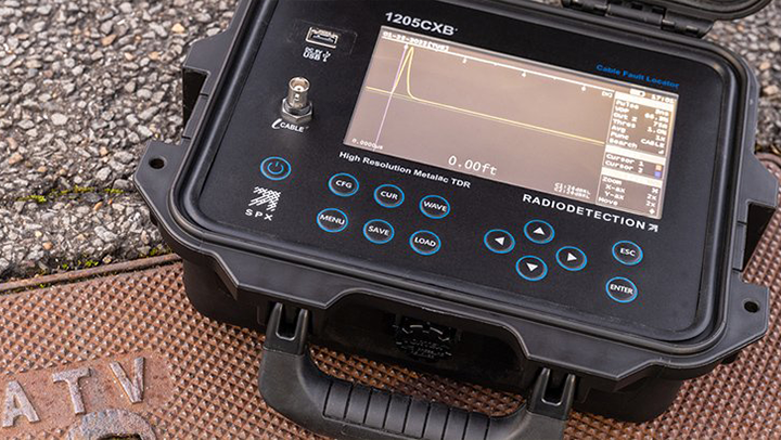
Cable Fault Location Systems
Accurately identify faults such as shorts, breaks, and insulation failures in underground power and communication cables using specialized diagnostic tools.
Video Camera Inspection Systems
Perform real-time visual inspections of underground pipes, sewer lines, and conduits to identify blockages, cracks, and structural issues.
Accessories
Enhance your subsurface detection capabilities with essential tools such as signal transmitters, sondes, batteries, and more.

Radiodetection PCMx Locator And Tx-25 PCM Transmitter Kit
Model #10/PCMX25KIT-CA


Cues 542 Flexiprobe 200' (60m) System with 2in Self-Leveling Camera
Model #10/542NTSC2-60-CUES

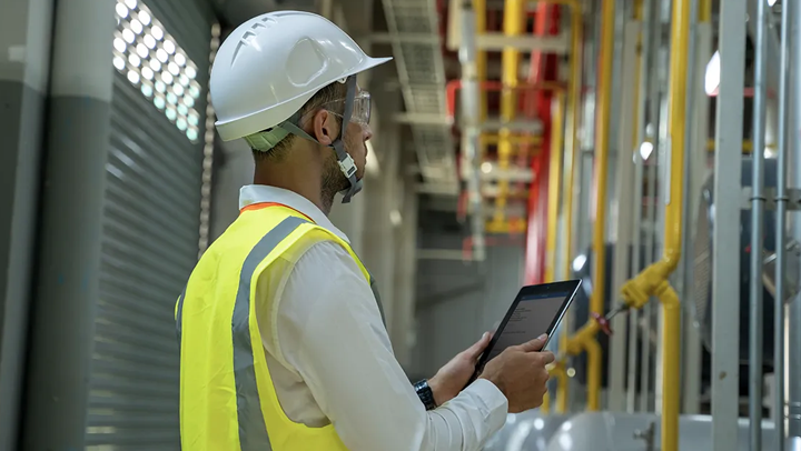
Subsurface Integrated Technology
Integrating subsurface technology and utility locators with modern geospatial, infrastructure, surveying, and mapping solutions enhances accuracy, efficiency, and decision-making.
Featured Technologies

LiDAR
Integrating LiDAR with subsurface data creates a comprehensive digital twin, allowing utility professionals to visualize both surface and underground assets seamlessly.

Geographic Information Systems (GIS)
Leveraging GIS integration enables precise mapping of underground assets and establishes a centralized digital twin—reducing risks while enhancing operations and maintenance.
GPS & GNSS Correction Services
Integrated with subsurface technology, these systems deliver centimeter-level accuracy for surveying and mapping underground assets, allowing field crews to precisely locate and document infrastructure.
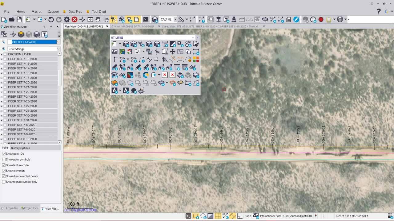
CAD
CAD synthesizes subsurface utility data to produce detailed, accurate models of underground infrastructure, thereby refining design, planning, and clash detection.
Enterprise Asset Management (EAM) Systems
Integrating utility location data into EAM platforms maintains up-to-date underground asset records and empowers agencies to efficiently manage and sustain their assets.

DJI Zenmuse L1 Bundle
Combine Livox LiDAR module, high-accuracy IMU, and 1-inch CMOS camera for dependable delivery of 3D data and precise models.
Model #902174

New TBC Enterprise Subscription - 2 Years
Powerful surveying and geospatial software that streamlines data processing, analysis, and visualization for accurate and efficient project delivery.
Model #902276

Trimble R980
High-precision GNSS receiver designed for reliable, centimeter-level accuracy in surveying, mapping, and infrastructure applications.
Model #902333


Can-Net
Canada’s leading Virtual Reference Station (VRS) network, offering real-time GNSS corrections for agriculture, geospatial, and construction using 300+ reference stations.
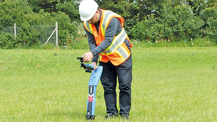
Precision Locator Range
Damage prevention and operational efficiency are the biggest challenges of most operators. Overcome these challenges with the cutting-edge precision locators from Radiodetection.
Our Radiodetection Cable and Pipe Locators are designed to swiftly, accurately, and safely locate and mark buried utilities across various industries. Whether you need a reliable, highaccuracy locator like the RD7200 for everyday use or the advanced RD8200 that simplifies the task of identifying utilities even in tough environmental conditions, we have the perfect tools to safeguard both technicians and infrastructure.
Discover how the Radiodetection Cable and Pipe Locators’ reputation for speed, precision, and reliable performance can increase the efficiency of your business operations:
- Easy to deploy and use - Provides fast, precise and repeatable measurements
- Sunlight readable display, high-performance audio system and vibration alerts for noisy environments
- Easy to set up and use
- Sensitive and accurate signal processing for reliable results
- Ergonomic design, premium quality
Invest in the best precision tool from Radiodetection and locate with confidence.

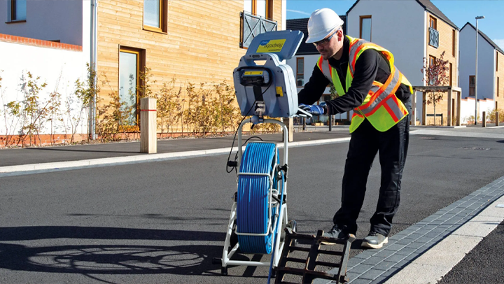
LMX® Ground Penetrating Radar (GPR) Systems
Ground Penetrating Radar (GPR) is a powerful technology that uses radio waves to create an accurate picture of what lies beneath the surface. By sending out a pulse of radio energy, GPR can detect and locate buried objects in real time. This information can be conveniently displayed in the field or integrated into maps and other deliverables.
If you’re looking to map the precise location and depth of a wide range of utilities, LMX is the industry’s most reliable brand of GPR. The LMX GPR systems are capable of detecting and characterizing buried utilities, including metallic, non-metallic, plastic, concrete, and even asbestos-concrete. By systematically scanning an area, LMX can effortlessly reveal the distribution and characteristics of multiple buried utilities for:
- Utility locating
- Engineering
- Construction
- Road and building maintenance
- Law enforcement, mining, archaeology
- UXO detection
- Geophysics and environmental assessment projects
Choose the LMX GPR system that best suits your utility locating needs.

Check out the LMX200™ GPR System
Introducing our premier GPR tool for utility locating professionals! It has all the capabilities of the LMX100™ and adds additional in-field capabilities such as Grid Scan data collection, SplitView and MapView. It also offers external GPS capabilities for mapping results and capabilities for data export, analysis, and reporting.
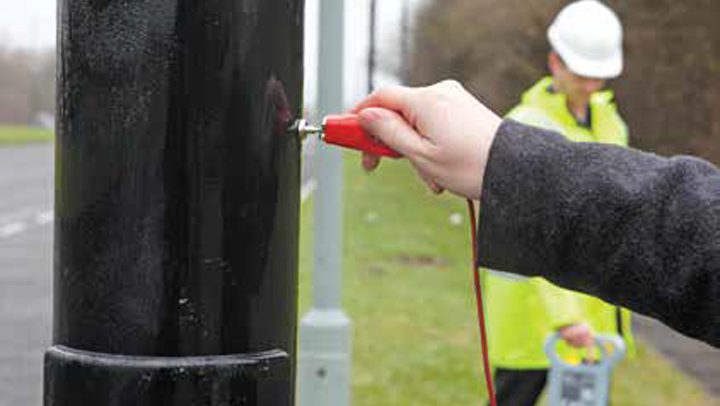
Schonstedt Magnetic Locators
Magnetic locators are capable of detecting underground objects that contain ferrous metals by utilizing the natural magnetic field of the earth. Rather than emitting a signal, these locators measure the distortion in the magnetic field surrounding a buried metal target.
With over 70 years of excellence to its name, Schonstedt® is a renowned global leader in the design and manufacture of magnetic locators. Its innovative HeliFlux dual-sensor technology detects the magnetic fields emitted by any buried iron object up to 20 feet beneath the surface of the ground with great precision.
The Schonstedt Magnetic Locator will revolutionize how surveyors, excavators, and construction workers pinpoint static objects at different depths. From small corner pins to massive tanks, drums, and septic tanks, our experts will guide you towards the ultimate solution for:
- Surveying & Mapping
- Water & Sewer
- Construction & Excavation
- Power & Electric
- Telecom & Cable
- Gas & Oil Pipelines
- Roads & Transportation
- And more!
Find the perfect Schonstedt magnetic locator for your subsurface project and budget.

Diagnostic, Inspection, and Locating
The benchmark in the field for durability, precision, and ease of use.
Built for Maximum Uptime
Don't let unseen problems hold you back; RIDGID tools help you find, visualize, and precisely locate the root of any issue with unmatched precision in the industry. Our reels, imaging cameras, monitors, locators, and recorders are designed to work together during locating tasks, ensuring quick setup and perfect compatibility.
And the greatest advantage: their durability is unmatched! They are built to withstand anything, whether you're repeatedly threading a cable through an iron pipe or hauling a reel out of a truck.

SOFTWARE
TerraFlow Mobile Now Supports Both iOS and Android Devices
TerraFlow Mobile is now available on iOS, alongside Android, expanding access to powerful mapping tools like Utility Mapper. The iOS version supports Apple Location Services and Radiodetection’s RD8200SG, while Android continues to work with a wide range of location providers. With enhanced visuals, filtering, and improved line workflows, TerraFlow Mobile provides a more efficient and intuitive field experience.
TerraFlow Utility Locate Mapper
Put your field data to good use with the industry’s most configurable and flexible utility mapping solution.
TerraFlow Utility Locate Mapper enables locate and engineering teams to gather information about their underground world and integrate it with other business systems such as their Geographic Information System and/or Enterprise Asset Management System.
- Locate Focused Workflows:
Create the workflows you need to capture the assets you want with whatever attributes you require. - Sketch:
Complete your public and private locate sketches in the field, leveraging the data captured. Build offsets and integrate your maps into your organization’s locate reports. - Configuration:
Administer your workflows with both your office and field teams through the web system. - API-Integration:
Integrate your Utility Mapper data with your asset repository. Synchronize with your GIS, export to CAD, and more.
Still have questions?