
Topographic Survey Basics: How to Get Accurate Results
Diving into the world of topographic surveys can be as fascinating as it is crucial for many professional fields, from architecture to environmental conservation. At its core, a topographic survey is your ultimate guide to understanding the lay of the land, detailing everything from the majestic rise of natural hills to the structured grid of urban streets.
This article peels back the layers on how these surveys work, why every line and measurement matters, and the tools that bring them to life. Whether you're planning a skyscraper or a new park, the insights from a topographic survey are invaluable, offering a detailed blueprint of the terrain that informs every decision.
Let’s navigate through the essentials of conducting a successful survey, the common pitfalls to avoid, and how to interpret the rich data these surveys provide. It's a journey through the highs and lows of our physical world, captured with precision and ready to inform the next big project.
What Is A Topographic Survey?
A topographic survey is a detailed and accurate representation of the natural and man-made features on a portion of the Earth's surface, highlighting variations in elevation and depicting elements such as buildings, trees, streets, rivers, and other significant details.
The primary goal of this type of survey is to provide a comprehensive overview of the terrain, which is essential for various applications including planning and design of construction projects, environmental management, and land use planning. By employing techniques like GNSS, laser scanning through devices like the Trimble SX12, and traditional surveying methods, topographers are able to create maps and models that accurately reflect the topography of the surveyed area.
These surveys are crucial for architects, engineers, and planners in making informed decisions about land development and management, ensuring that projects are designed with a thorough understanding of the underlying terrain.
Why Is Accuracy Important In Topographic Surveys?
Accuracy in topographic surveys is paramount due to its legal implications, construction accuracy, and environmental impact assessments. Let’s take a closer look at the impact accuracy has on projects and potential complications.
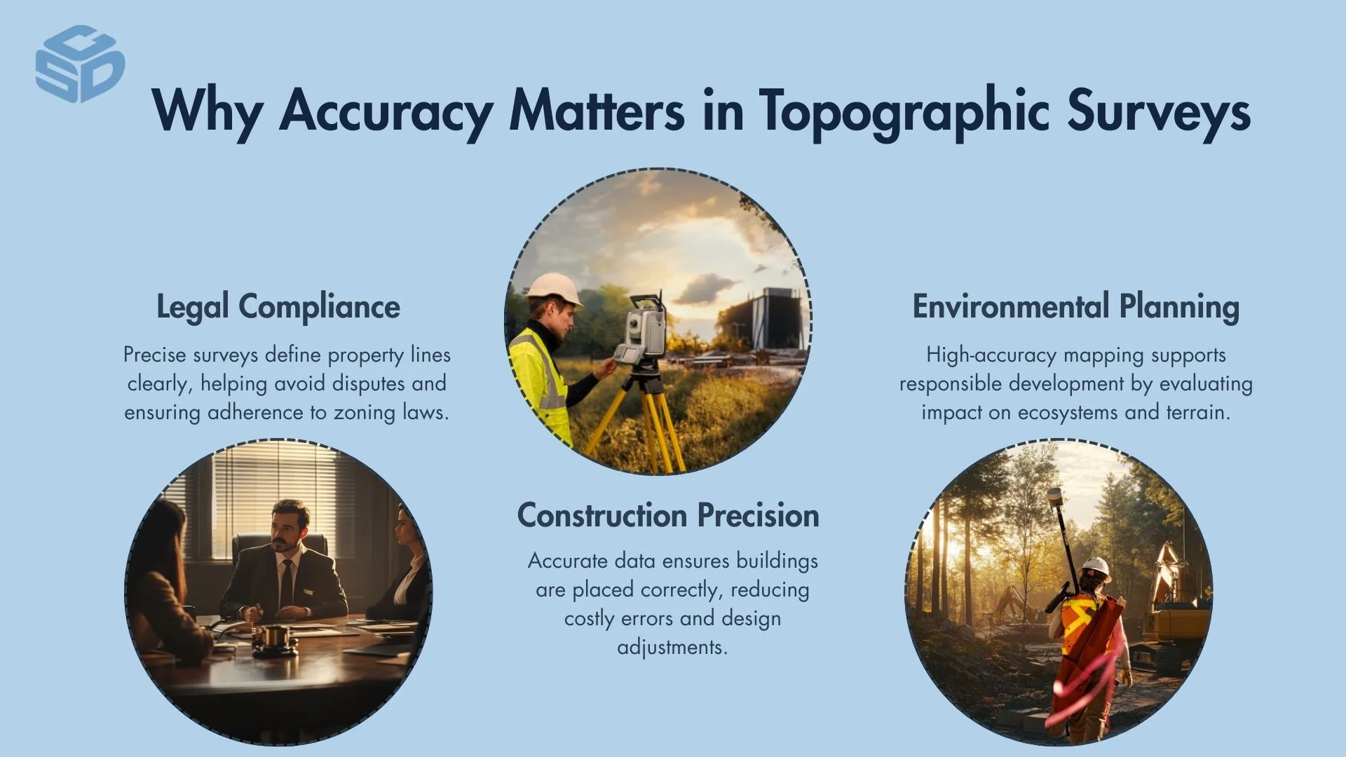
Legal Implications
Accurate topographic surveys are critical for delineating property lines, ensuring legal compliance and preventing disputes over land use and ownership. Precision in mapping boundaries safeguards against potential legal challenges and complications.
Construction Accuracy
In the realm of construction, the accuracy of a topographic survey directly influences the design and execution of a project. It ensures that structures are built in the correct location and according to the planned specifications, minimizing the risk of costly errors and modifications.
Environmental Impact Assessments
For environmental impact assessments, the precision of topographic data is essential for evaluating how a project interacts with its surroundings. Accurate surveys help in assessing potential impacts on water flow, vegetation, and wildlife habitats, guiding sustainable development practices.
What Tools Are Required For A Topographic Survey?
Topographic surveys rely on a range of tools to measure and map the Earth's surface accurately. Total stations such as the Trimble S7 5 Second Robotic Total Station, which utlizes electronic distance measurement (EDM) technology, are pivotal for capturing precise distances and angles.
GNSS units are essential for determining exact geodetic locations, with differential GNSS offering enhanced accuracy. These tools collectively enable the detailed and accurate collection of geospatial data, fundamental for creating comprehensive topographic maps and models.
Total Stations
Total stations combine the functionalities of electronic theodolites and EDM devices, making them indispensable for accurately measuring both angles and distances. Their integration is key for gathering the comprehensive spatial data required for precise topographic mapping.
GNSS Units
GNSS units have become essential in modern topographic surveying, offering the ability to establish exact geographical coordinates with ease. Utilizing satellite technology, they enable efficient and precise location pinpointing over vast areas.
Automatic Levels for Elevation Measurement
Automatic levels enhance the process of elevation measurement by automatically adjusting to create an accurate horizontal plane. This automation ensures high efficiency and precision in capturing elevation data, streamlining the surveying process.
How To Prepare For A Topographic Survey
Preparing for a topographic survey involves site reconnaissance and gathering existing data and maps. Initially, a thorough examination of the site is crucial to understand the terrain and identify potential challenges. This reconnaissance aids in planning the survey more effectively.
Simultaneously, collecting existing geographical data and maps of the area provides a foundational understanding, helping to pinpoint areas of interest and ensuring a comprehensive approach. These preparatory steps are essential for conducting a successful topographic survey, enabling accurate data collection and efficient survey execution.
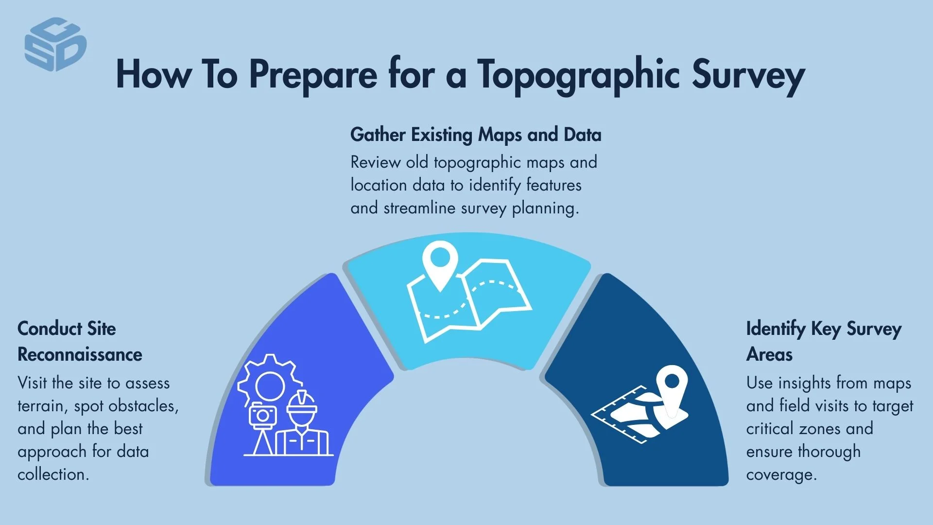
Site Reconnaissance
Site reconnaissance involves a crucial on-site evaluation to familiarize with the terrain and identify any potential obstacles or distinctive features. This step enables surveyors to plan an effective strategy, ensuring a smooth and efficient surveying process.
Gathering Existing Data and Maps
Gathering existing data and maps plays a foundational role in the preparation for a topographic survey. Accessing and analyzing previously collected geographical information and existing topographic maps provides invaluable insights into the survey area’s characteristics. This preparation aids in pinpointing areas of interest and navigating potential challenges, streamlining the subsequent survey efforts.
What Are The Steps To Conduct A Topographic Survey?
Conducting a topographic survey involves a series of methodical steps: establishing control points, setting benchmarks and reference points, conducting fieldwork, measuring angles and distances, data processing, and creating digital elevation models (DEMs).
Initially, surveyors establish control points to serve as a reference framework for the survey. Then, benchmarks and additional reference points are set to guide the detailed survey work.
During fieldwork, surveyors measure angles and distances between points on the terrain. This raw data is then processed to create accurate representations of the area, culminating in the creation of digital elevation models. These steps ensure the collection of precise and comprehensive topographical data.
Establishing Control Points
Establishing control points is the critical first step in a topographic survey, setting up precise, fixed locations that form the foundational reference system for all subsequent measurements. These control points are essential for ensuring the survey's overall accuracy and integrity.
Setting Benchmarks and Reference Points
After establishing control points, setting benchmarks and reference points provides additional layers of reference, marking specific, carefully chosen locations across the survey area. These benchmarks support consistent and accurate data collection throughout the surveying process.
Conducting Fieldwork
The next phase, conducting fieldwork, involves on-ground data collection. Surveyors traverse the site, identifying and documenting both natural and man-made features, and gathering the crucial measurements that define the landscape's characteristics.
Measuring Angles and Distances
A key fieldwork component is measuring angles and distances between the established control points and various features within the survey area. Precision in these measurements is vital, as they directly influence the survey's final accuracy.
Data Processing
Once field data is collected, data processing transforms the raw measurements into meaningful, accurate information. This stage includes analyzing, adjusting, and compiling data taken from devices such as the Trimble TSC5 Data Collector, ensuring it accurately represents the surveyed terrain.
Creating Digital Elevation Models (DEMs)
The final step, creating digital elevation models (DEMs), involves using the processed data to generate digital representations of the terrain's elevation. These models provide a detailed, three-dimensional view of the surveyed area, showcasing its topographical features with remarkable clarity and precision.
How To Ensure Data Accuracy During A Topographic Survey
Ensuring data accuracy in a topographic survey is achieved through calibrating instruments prior to the survey and double-checking measurements.
Implementing calibration checks before the start of the surveying process is vital for maintaining the precision of measurements. This initial assessment helps identify any deviations from accuracy, allowing for immediate correction and ensuring consistent data quality.
But even with initial calibration, surveying teams should make it a point to double-check measurements as a critical safeguard against errors. By verifying data at various points, surveyors can catch and correct discrepancies early, significantly enhancing the survey's overall accuracy.
What Are Common Mistakes To Avoid In Topographic Surveys?
In topographic surveys, common mistakes to avoid include poor planning, underestimating survey complexity, inadequate fieldwork, skipping control points, incorrect data interpretation, and misreading elevation data. Avoiding these issues is crucial for ensuring the accuracy and reliability of topographic survey results.
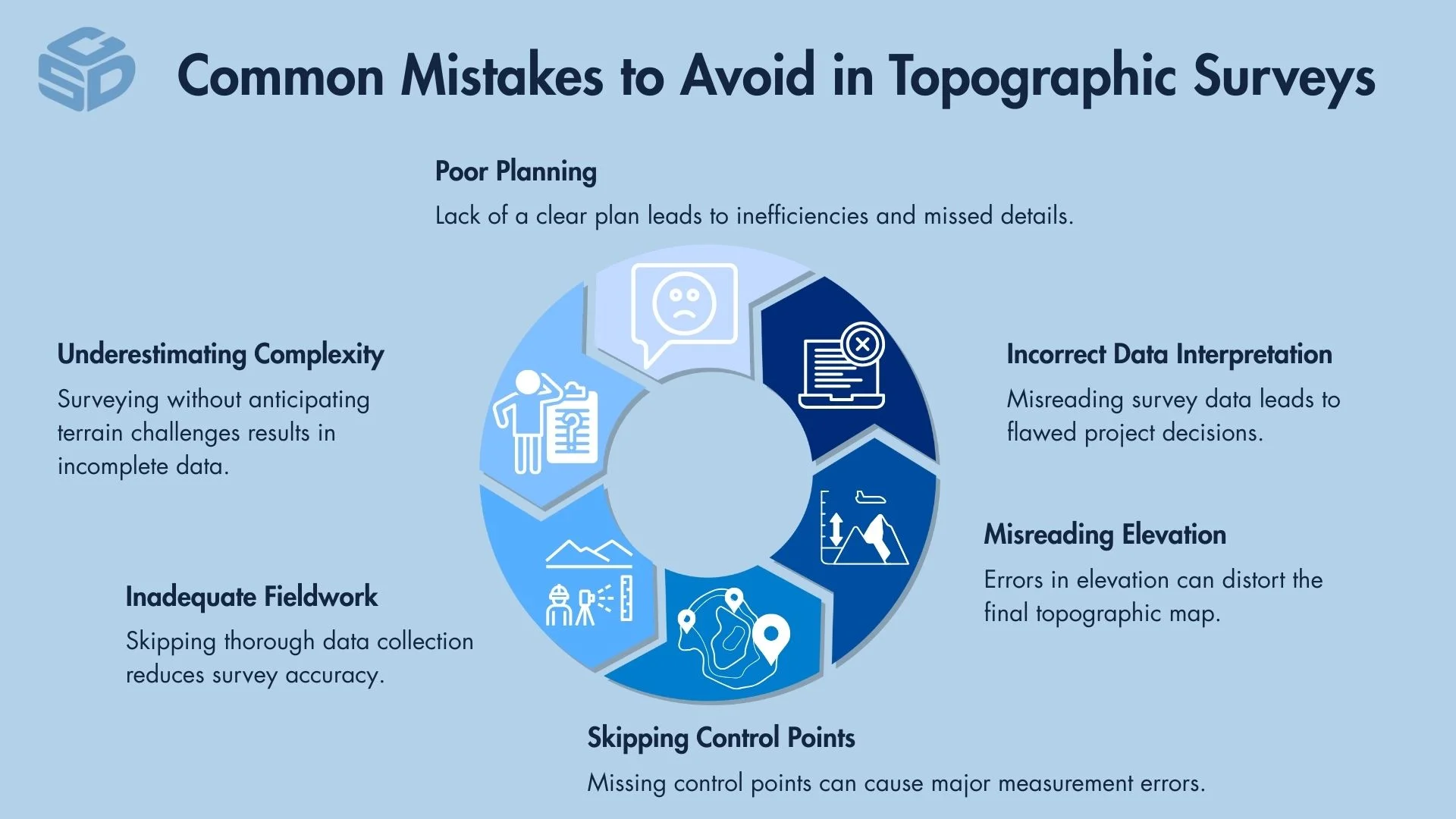
Poor Planning
Poor planning can significantly impact the success of a topographic survey. Without a comprehensive plan that considers resources, timelines, and the project's scope, surveyors may encounter preventable obstacles.
Underestimating Survey Complexity
Underestimating the complexity of a survey can lead to insufficient preparation and resources. Recognizing and planning for the intricacies of the survey area is essential for thorough data collection and analysis.
Inadequate Fieldwork
Inadequate fieldwork undermines the survey's quality and accuracy. Detailed and meticulous data collection is crucial to capture an accurate representation of the terrain.
Skipping Control Points
Skipping control points introduces errors that can compromise the entire survey. Establishing and using control points through GNSS, triangulation, or total stations like the Trimble S5 1 Second Robotic Total Station accurately is fundamental for the precision of the survey data.
Incorrect Data Interpretation
Incorrect data interpretation can result in erroneous conclusions, affecting project outcomes. Accurate analysis and understanding of the collected data are vital for reliable survey results.
Misreading Elevation Data
Misreading elevation data affects the accuracy of the topographic model, potentially leading to flawed project planning. Precise interpretation of elevation data is critical for creating accurate topographic maps.
How To Interpret Topographic Survey Results
Interpreting topographic survey results involves understanding contour lines, scale, and symbols used in the survey maps. Mastery of these elements is essential for effectively utilizing topographic survey results in project planning, environmental management, and land use decisions.
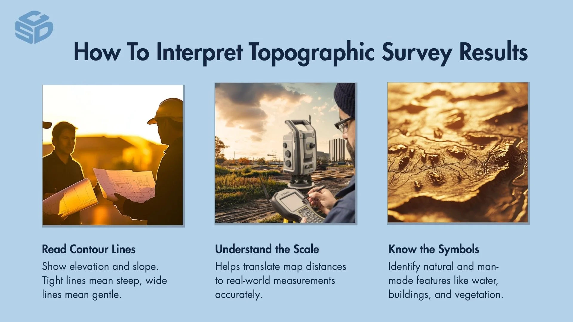
Reading Contour Lines
Reading contour lines is essential for grasping the terrain's elevation and slope characteristics. Contour lines link points of identical elevation, creating a visual representation of the landscape's form. Closer spacing of these lines signifies steeper gradients, while wider spacing indicates gentler slopes.
Understanding Scale and Symbols
Understanding the scale and symbols on a topographic map is critical for accurate interpretation. The scale provides a measure of real-world distances, allowing users to gauge the extent of features and distances accurately. Symbols, on the other hand, offer insights into the map's various natural and man-made elements, such as types of vegetation, bodies of water, and buildings.
Familiarity with these symbols, combined with a clear understanding of the map's scale, is key to effectively utilizing topographic survey results for planning and analysis.