


CSDS Real-Time Network
California's Most Reliable Network
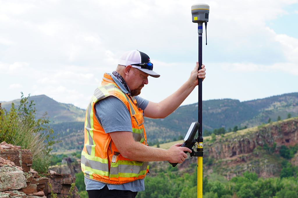
The California Surveying and Drafting Supply Virtual Station Network (CSDS RTN) is a dynamic GNSS Real-Time Kinematic Network that provides more reliability, coverage, and accuracy than traditional single-base networks.
What is the CSDS RTN
Achieve one-centimeter accuracy
The CSDS RTN provides RTK corrections to your equipment, enabling you to achieve up to one-centimeter accuracy. With no need for a station or rover radio, CSDS RTN users are able to reduce their hardware costs by up to 50% while achieving better accuracy to your precision surveying & mapping applications.
More Coverage Where You Work
Six New Stations Are Now Live In Southern California
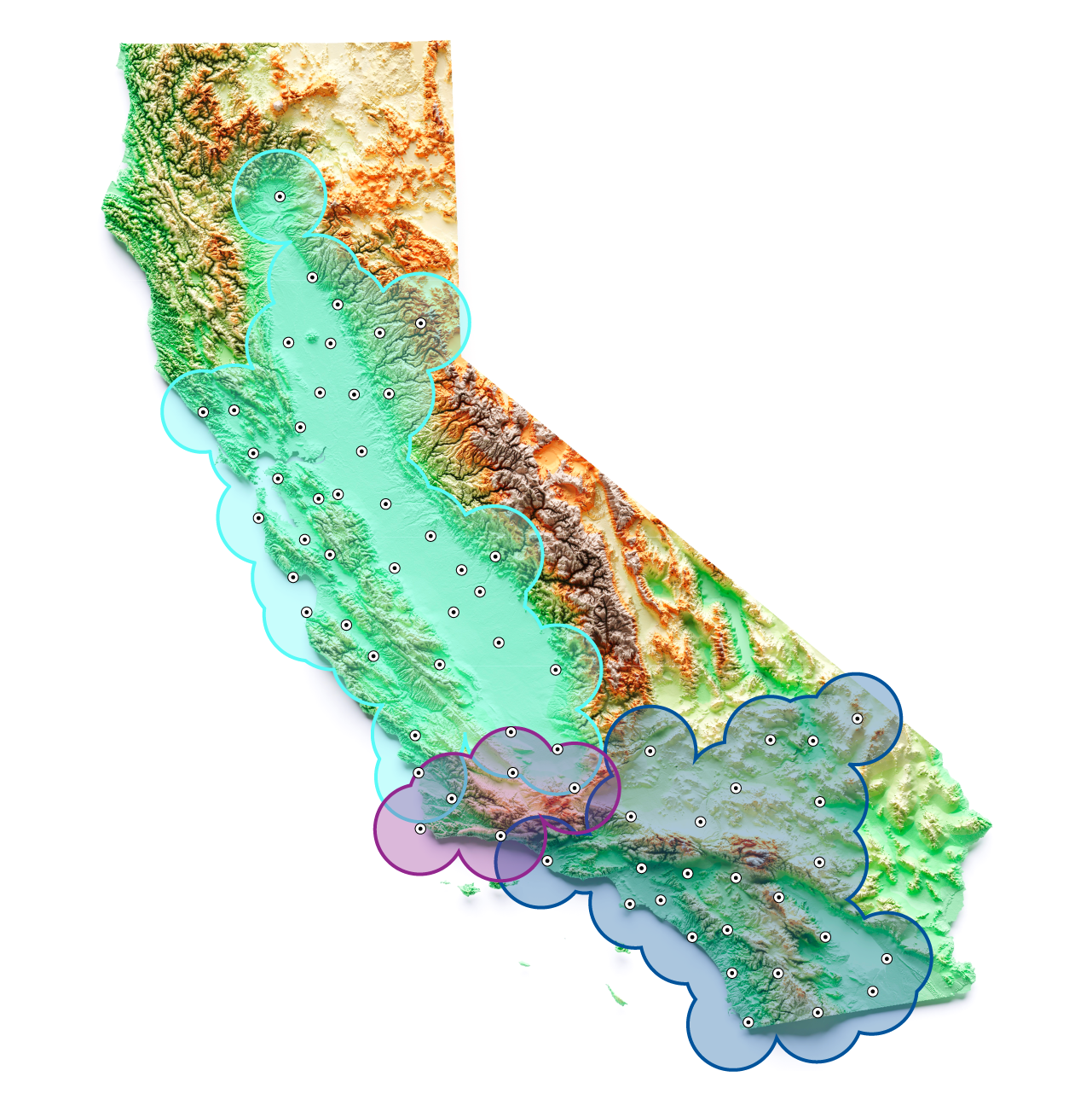
The CSDS Real-Time Network now covers more ground than ever. Six new stations extend high-precision coverage across Santa Barbara County, Ventura County, Western Los Angeles County, and Western Kern County.
The new stations also link our Northern and Southern California networks, so you can move between jobs across more of the state and keep reliable corrections the whole way.
What's New
- 6 New Stations - Live now
- New Coverage - Across Santa Barbara, Ventura, western LA, and western Kern counties
- Northern and Southern California Networks - Are now more closely connected
- 116,500 square miles of Coverage - Supporting one of California's largest privately owned GNSS networks focused on the surveying, construction, infrastructure, agriculture, and utility markets
Benefits
Why Surveyors Choose the CSDS RTN
Our real-time and post-processed VRS correction services give you clear advantages over single-station RTK.
Lower Hardware Costs
You need only a rover and a cellular/IP connection, so you save about 50% compared with conventional RTK, and there's no base station to buy or maintain.
More Efficient Erews
Several crews can work at the same time, anywhere in the network.
More Productive Days
You don't have to scout base station sites, and you can start working right away. Simply Connect, Correct, Measure.

What areas does the CSDS RTN cover?
CSDS RTN services are available over two networks:
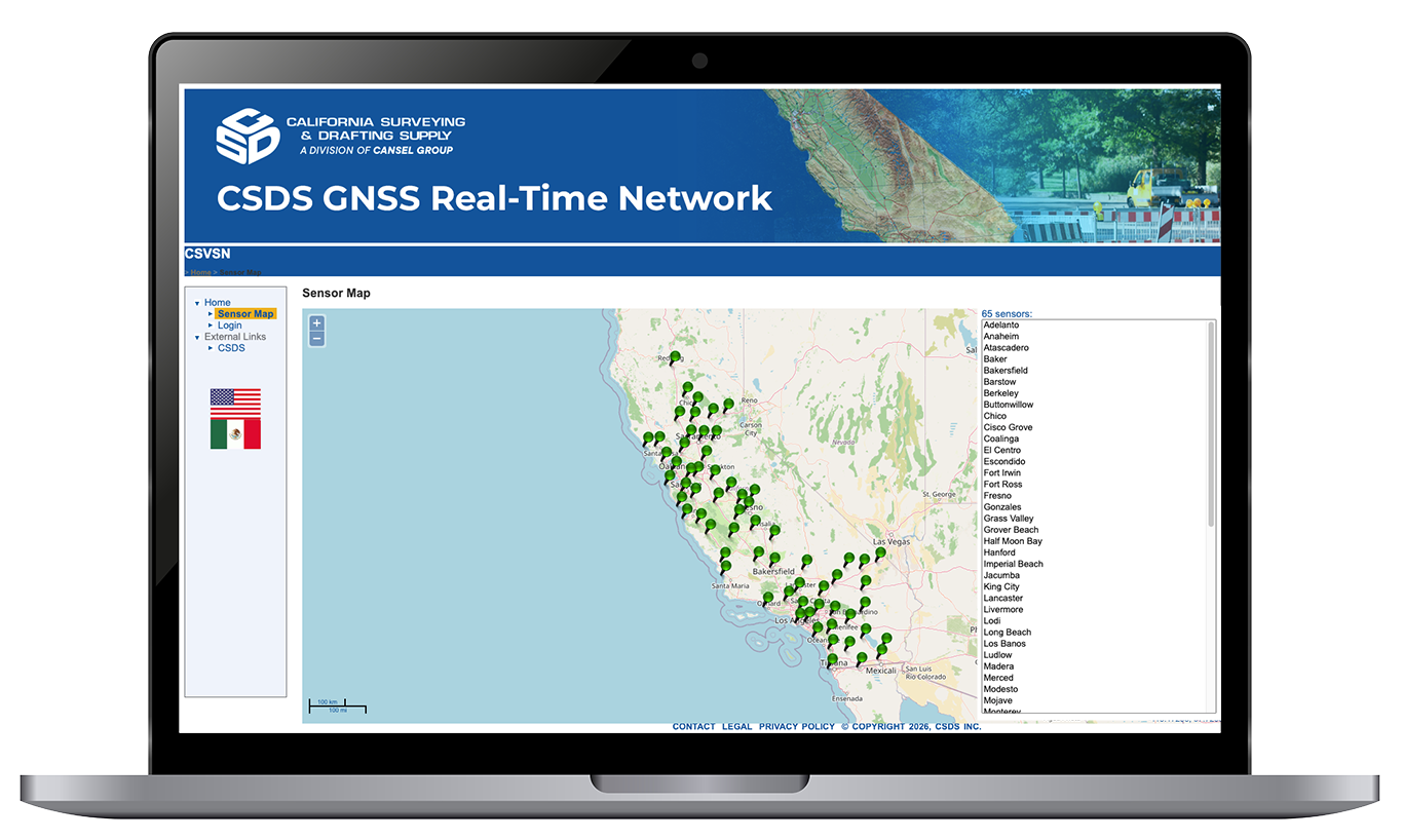
- Northern California, which spans from Redding to Bakersfield,
- Southern California, which spans from Lancaster to Imperial Beach.
Our service area currently covers 105,000 square miles, making the CSDS RTN California’s largest GNSS network — and it's continuously expanding!
How does the CSDS RTN work?
Our network is fully redundant ensuring no signal is lost. We utilize dedicated technology that manages and monitors over 60 reference stations across California. This helps ensure accuracy and network availability regardless of power outages, loss of reference stations, or reference station movement due to seismic activity.
What products does the CSDS RTN work with?
The CSDS RTN works with virtually all major surveying and GIS/GPS products.
How can I utilize the CSDS RTN?
The CSDS RTN subscriptions are sold by California Surveying & Drafting Supply. Call 1 (800) 243-1414 or email [email protected] to find out which solution is best for you.
Benefits
The real-time and post-processed VRS correction services provide a number of significant advantages to users over single station RTK.
Hardware Costs:
- 50% savings over conventional RTK as VRS only requires a rover receiver and cellular/IP connectivity. No base station investment or maintenance costs.
Efficiency of Deployment:
- Multiple crews can be deployed at one time and work simultaneously.
Productivity Improvements:
- Begin working immediately.
- No need to investigate base station sites.
- Simply Connect - Correct - Measure. It's that easy!
Services
- Real-time data is available in a variety of subscription terms for versatility of use
- Subscriptions are also available with the rental of an RTK rover
- Post-processed data is available as a yearly subscription
After subscribing to post-processed services, go to www.csvsn.com and click "User Web Portal" to log in to your account to access and manage data files.
For real-time services you will need a valid CSDS RTN account, cellular/IP connectivity and GNSS equipment. Virtually any data-enabled modem integrated within a guidance device or as a stand-alone component can be used.
Once configured, the CSDS RTN service is very simple to use. Your local CSDS Real-Time Network's technical support representatives are always happy to assist users.
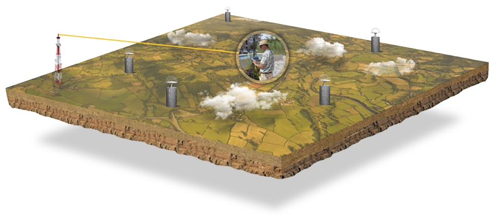
How Virtual Reference Station Networks Work
Simply Connect. Correct. Measure.
CSDS VRS Now provides positioning professionals with instant access to Real-Time Kinematic (RTK) and Post-Processing (PP) corrections utilizing a network of permanent (fixed) reference stations. With no base station or setup required, it is cost-effective, efficient and simple to use GPS/GNSS positioning based on a set of reference stations.
Support
CSDS RTN Support Center
Reference Frame: NAD83-2011
| Epoch: | 2010.00 |
| 2017.50 | |
| 2025.00 |
Regular network adjustments are performed in June and December to account for tectonic movement.
The CSDS RTN operates two interconnected GNSS networks delivering more than 116,500 square miles of coverage across California. The Northern California network extends from Redding through Ventura and Los Angeles counties, while the Southern California network reaches from Imperial Beach north into San Luis Obispo and Kern counties. Together, they support one of California's largest privately owned GNSS networks serving surveying, construction, infrastructure, agriculture, and utility professionals. View the updated coverage map for details.
Reliability is built into every layer of the CSDS RTN. Dedicated technology continuously monitors and manages more than 71 reference stations across California, while a fully redundant network architecture helps ensure consistent service and accuracy during power outages, equipment failures, and seismic events.
The CSDS RTN works with virtually all major surveying and GIS/GPS products.
You need a valid CSDS RTN account, a cellular/IP connection, and GNSS equipment. Almost any data-enabled modem will work, whether it's built into your device or stands alone. Once you're set up, the service is simple to use, and our local technical support team is always ready to help.
Real-time data comes in a range of subscription terms. Subscriptions are also available with an RTK rover rental. Post-processed data is available as a yearly subscription.
After you subscribe, go to www.csvsn.com and click User Web Portal to log in, then access and manage your data files.
CSDS RTN subscriptions are sold by California Surveying & Drafting Supply. Call (800) 243-1414 or email [email protected] and we'll help you choose the right option.