


DJI Zenmuse L3
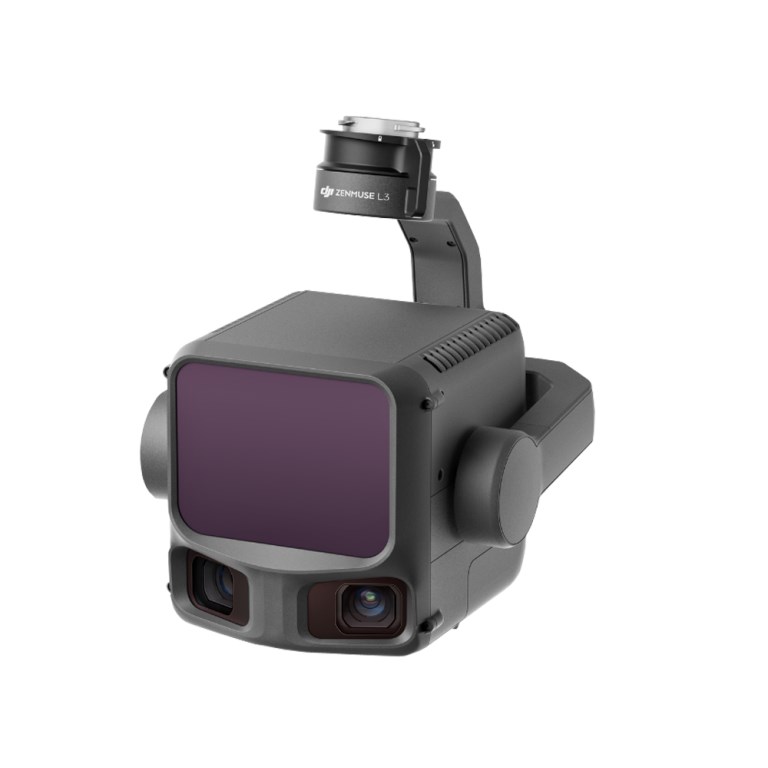
DJI Zenmuse L3
Description
DJI Zenmuse L3 — Enterprise LiDAR & RGB Mapping Payload
The DJI Zenmuse L3 is a next-generation airborne LiDAR and RGB imaging payload built for high-accuracy surveying, mapping, and inspection workflows. Designed for seamless integration with DJI enterprise drones like the Matrice 400 series, the L3 delivers dense, survey-grade point clouds and high-resolution imagery in a single flight — dramatically improving efficiency for large-area and complex terrain projects.
Key Features — Zenmuse L3
- High-Precision LiDAR Mapping
Long-range 1535 nm LiDAR with adjustable pulse rates up to multiple MHz provides up to 950 m detection range on typical targets and supports up to 16 returns per pulse for dense 3D point clouds through vegetation and structures. - Dual RGB Mapping Cameras
Integrated dual 100 MP 4/3 CMOS sensors with a combined 107° horizontal field of view capture high-resolution RGB imagery. Each camera uses a 28 mm equivalent lens with adjustable aperture (f/2.0–f/11) and mechanical shutter to produce crisp photos up to 100 MP, supporting rich colorized point clouds, orthophotos, and photogrammetric deliverables. - Advanced Imaging & Capture
Dual cameras offer multiple capture resolutions (100 MP and 25 MP) with fast minimum photo intervals, and support 4K video (H.265/MP4) — enabling versatile data collection for context mapping, feature extraction, and visual inspection. - Enterprise-Grade Accuracy & POS
Tight coupling with RTK/PPK positioning, high-precision IMU performance (yaw ~0.02°, pitch/roll ~0.01°), and robust georeferencing ensure survey-quality accuracy that supports engineering-grade mapping and critical asset analysis. - Seamless DJI Integration
Engineered for end-to-end workflows with DJI Pilot 2 mission planning, DJI Terra and DJI Modify processing, and FlightHub 2 data management — streamlining capture to deliverable pipelines.
Ideal For
Surveyors, geospatial professionals, and enterprise operators who need a single payload capable of producing survey-grade LiDAR point clouds alongside high-resolution RGB imagery. Perfect for topographic surveys, corridor mapping, utility and power-line inspection, forestry analysis, construction monitoring, and infrastructure asset management where detailed spatial context and precise 3D data are critical.
Documents
There are no documents available.
Specifications
- BrandDJI Enterprise
- Product TypeDrone Payload
- Camera24 MP
- Combined Horizontal FOV107°
- Gimbal3-Axis Stabilized Gimbal
- IP RatingIP54
- Laser Beam Divergence0.25 mrad (1/e²)
- Laser Spot Size41 mm @ 120 m (1/e²); 86 mm @ 300 m (1/e²)
- Laser Wavelength1535 nm
- Minimum Effective Detection Distance10 m
- Payload TypeLiDAR Mapping and Photogrammetry
- Photo Size6144×4096
- Point Cloud System AccuracyAt 120m Flight Altitude: Vertical Accuracy: 3 cm (RMSE) & Horizontal Accuracy: 4 cm (RMSE), At 300m Flight Altitude: Vertical Accuracy 5 cm (RMSE) & Horizontal Accuracy: 7.5 cm (RMSE)
- Point Cloud Thickness1.2 cm@1σ (120m nadir flight altitude); 2 cm@1σ (300m nadir flight altitude)
- Power64 W (typical), 100 W (max)
- Ranging AccuracyAbsolute Accuracy: ±10 mm; Repeatability: < 5 mm (1σ)
- RGB Ground Sampling DistanceAverage Value: 3 cm (300m nadir flight altitude)
- Service PlanDJI Care Enterprise Plus
- Supported AircraftDJI Matrice 400 (requires the Zenmuse L3 single gimbal connector)
- Warranty Plan1 year
- Weight1.60 kg (without single gimbal connector)