
WingtraRAY SURVEY61 Payload
WingtraRAY SURVEY61 Payload
Description
WingtraRAY SURVEY61 Payload
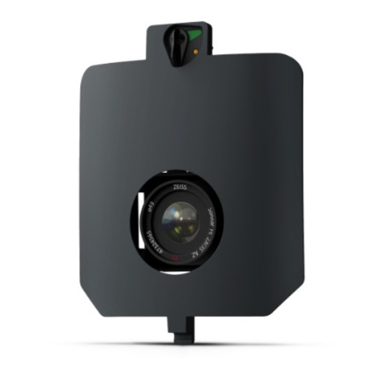
The WingtraRAY SURVEY61 is a premium survey-grade photogrammetry payload anchored by a 61 MP full-frame nadir camera with a low-distortion 35 mm lens. Configured for maximum data fidelity, it achieves fine ground sample distances down to 0.5 cm / 0.2 in at standard survey altitudes and delivers ~3 cm RMS absolute accuracy without the need for ground control points when paired with PPK.
SURVEY61 combines high resolution with large coverage efficiency — capturing hundreds of hectares in a single sortie while maintaining the detail required for infrastructure planning, BIM integration, as-built surveys, and urban modeling.
Key Features
- 61 MP full-frame nadir sensor with low-distortion lens
- Survey-grade photogrammetry with PPK accuracy (~3 cm RMS)
- Fine GSD outputs (down to 0.5 cm)
- Extensive coverage per flight for enhanced efficiency
- Workflow integration from mission planning to processing
Ideal For
Civil engineering, construction progress monitoring, topographic basemapping, urban planning, and any surveying application where high-precision photogrammetry and absolute geolocation are essential.
Documents
Specifications
- BrandWingtra
- Product TypeDrone Payload
- Absolute Accuracy (RMS x, y, z) with PPK3 cm
- Lowest Possible GSD0.5 cm/px at 46 m altitude
- Maximum Coverage at 120 m310 ha
- Payload TypePhotogrammetry
- Sensor61 MP - Full-frame sensor, low-distortion lens (35 mm), nadir configuration