Precision Restoration:
How SCWA Modernized Habitat Conservation with the CSDS Real-Time Network (RTN) + Trimble GNSS
The Project
Habitat restoration, channel stability monitoring, and environmental engineering along Putah Creek—capturing precise as-built data and repeatable measurements to manage a dynamic, living waterway.
Challenge
Modernizing outdated GPS workflows that struggled under dense riparian canopy, required time-consuming base station setups, and necessitated repeat site visits due to inconsistent data.
Solutions
Flagship Trimble GNSS rovers paired with the CSDS Real-Time Network (RTN) and Trimble Access software. The solution was optimized through professional configuration and expert training led by CSDS Account Manager Brett Clarke.
Outcome
Sub-centimeter accuracy, eliminated base station hardware, significantly reduced field time, and improved data confidence—all supported by CSDS as a long-term technical and environmental engineering partner.
Background
Solano County Water Agency (SCWA) is a public agency responsible for water resource management, flood control, and habitat conservation. A primary focus of their mission is the long-term environmental health of Putah Creek, a complex system requiring constant monitoring and infrastructure maintenance.
The Project
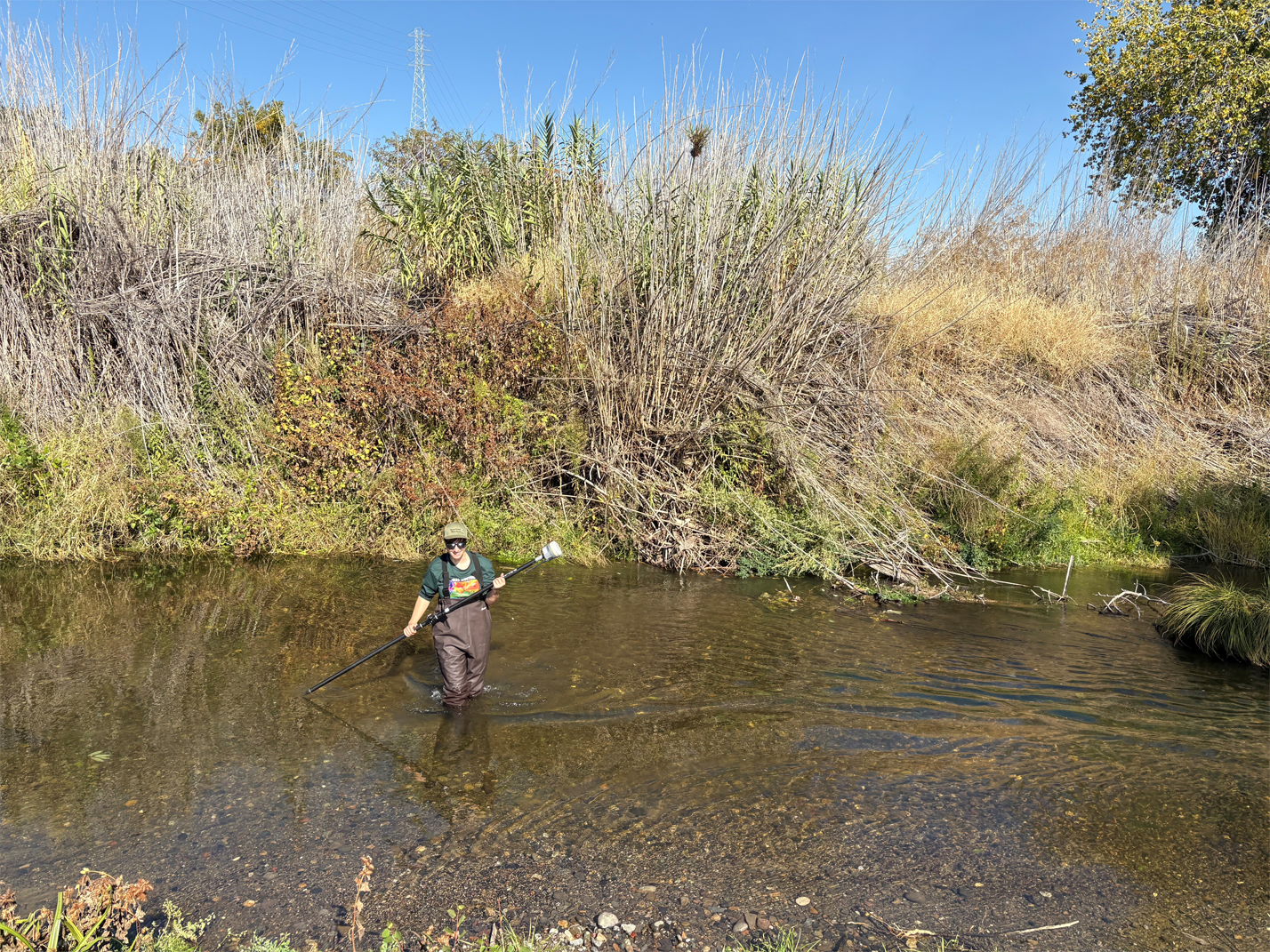
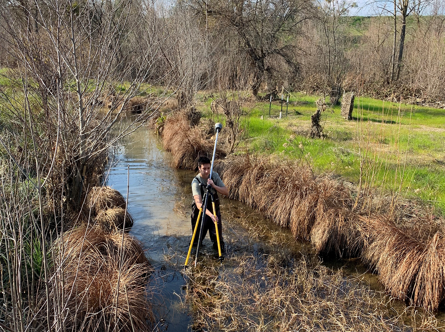
SCWA’s engineering team, led by Gavin Poore, designs and monitors critical restoration features including graded banks, riffles, and in-channel structures. These projects require highly accurate as-built surveys to track how the creek responds to environmental changes over time. Because Putah Creek is a "living system," the data must be repeatable and precise to ensure the success of long-term restoration goals.
The Challenge
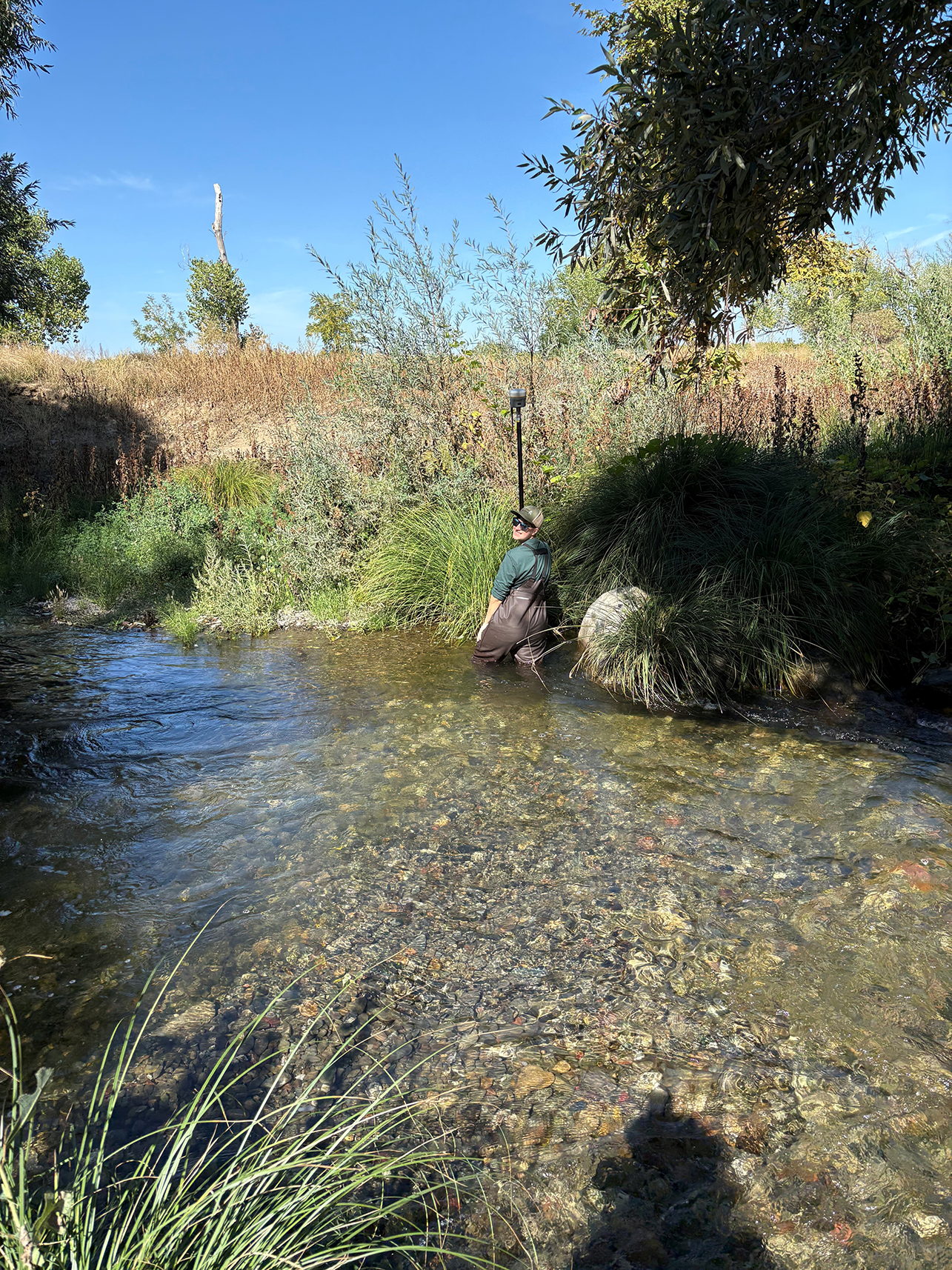
As restoration efforts expanded, SCWA’s existing surveying workflows hit a ceiling. Traditional GPS methods were hindered by the heavy tree canopy common along creek banks, often resulting in slowed office processing and the need for repeat site visits to capture a single area.
Furthermore, the logistical burden of setting up physical base stations in remote or limited-access riparian areas created safety concerns and slowed down the daily pace of fieldwork. SCWA needed a way to move faster without sacrificing the sub-centimeter precision required for hydraulic modeling and engineering.
“As a civil engineer for SCWA, my primary focus is the habitat restoration of Putah Creek. It’s a project where the accuracy of our surveying efforts directly impacts the long-term environmental health of the waterway.”
Gavin Poore
Assistant Water Resources Engineer, SCWA
Why CSDS?
SCWA needed more than new equipment – they needed a partner who understood surveying, environmental restoration, and public agency workflows. CSDS’s Geospatial Solution Specialist Brett Clarke (PLS), worked closely with Gavin to define objectives, select the right Trimble technology, and design a workflow that prioritized safety, speed, precision, and reliability in challenging field conditions.
Solutions Deployed
- Flagship Trimble GNSS Rover: Providing ultra-fast initialization and centimeter RTK accuracy.
- CSDS Real-Time Network (RTN): Delivering reliable real-time corrections without the need for a physical base station.
- Trimble Access: Utilizing rugged controllers to optimize field workflows.
- CSDS Technical Enablement: Expert configuration, training, and ongoing support led by our Technical Enablement Team to ensure seamless field deployment.
Implementation & Results
By leveraging CSDS RTN paired with premier Trimble GNSS, SCWA eliminated the time and complexity of setting up base stations - a critical advantage in riparian areas where access is limited or unsafe. Field crews now begin surveying immediately, with reliable corrections and consistent accuracy throughout Putah Creek.
Trimble’s speed and precision significantly reduced field time while improving data confidence. Surveys that previously required multiple visits can now be completed accurately in a single trip, with clean data flowing directly into SCWA’s CAD and GIS systems.
Impact on Workflow
- Faster field operations with no base station setup
- Higher accuracy under the canopy and along creek banks
- Fewer revisits and reduced labor costs
- Long - term monitoring with repeatable data
“Trimble GNSS combined with the CSDS RTN gives us the speed and reliability we need. We’re capturing what’s really happening in the creek – not guessing.”
Gavin Poore
ACKNOWLEDGMENTS:
Solano County Water Agency (SCWA) is a public agency dedicated to providing a reliable water supply, flood control, and environmental conservation for Solano County. They are leaders in the design and monitoring of complex habitat restoration and water resource projects. Learn more about their work at scwa2.com.
Special thanks to Gavin Poore, Assistant Engineer / Civil Engineer at SCWA, for his leadership on these surveying efforts and his commitment to the long-term health of Putah Creek.
Gavin credits CSDS – and Brett Clarke in particular – for making the transition seamless. From initial consultation through field deployment, CSDS ensured the technology aligned with SCWA’s environmental and engineering goals. The ongoing partnership gives SCWA confidence as restoration efforts continue to expand.
The CSDS Real-Time Network (RTN)
Powering over 105,000 square miles of California with 60+ monitored reference stations, the CSDS RTN provides unmatched GNSS accuracy and availability for professionals who can’t afford downtime.
Discover California’s largest and most trusted RTN →
Surveying & Mapping Solutions
From urban planning to environmental conservation, CSDS provides the advanced geospatial technology and expert guidance necessary to turn complex field data into actionable insights. We empower our partners to make informed decisions for infrastructure, land use, and natural resource management.
Our Customer Success Stories
At CSDS, we take pride in showcasing the achievements of our customers who trust us as their technical partner. We are committed to providing the most advanced solutions to ensure your project’s success, no matter the challenge.